Lake Facts
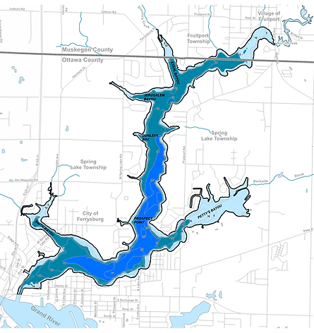
Spring Lake is a drowned river mouth lake that formed as a result of fluctuating water levels in the glacial Great Lakes. With a surface area of 1,091 acres, Spring Lake is the 85th largest lake in Michigan. The mean or average depth is Spring Lake is about 18 feet and the lake contains 19,845 acre-feet of water--a volume that would cover 31 square miles to a depth of one foot. The shoreline of Spring Lake is over 25 miles long. The shoreline development factor of 5.5 indicates that the shoreline of Spring Lake is 5.5 times longer than if the lake were perfectly round. The level of Spring Lake fluctuates with the level of Lake Michigan.
Spring Lake has a long and convoluted shoreline. Several bayous exist where small tributaries drain into the lake. Prior to development, the bayous were marsh areas rich in wetland vegetation. As the Spring Lake area became more urbanized, the bayous were developed and some were dredged to create navigation channels. The bayous tend to be shallow with highly organic sediments that provide ideal growing conditions for aquatic plants.

Spring Lake Depth Contour Map
Spring Lake Bio-Volume Map

